Introduction
Land Records & GIS Cadastral Systems are software platforms used by government agencies to manage property records, parcel maps, ownership details, land boundaries, deeds, surveys, titles, assessments, zoning layers, and geospatial data. In simple words, these systems help land administration teams maintain accurate digital records of who owns land, where land boundaries are located, how parcels are classified, and how property information connects with maps.
These systems matter because land data supports taxation, planning, infrastructure, legal ownership, permitting, public works, agriculture, urban development, and dispute resolution. When land records are outdated, incomplete, or disconnected from GIS maps, agencies can face delays, errors, ownership conflicts, weak revenue collection, and poor public service delivery.
Common use cases include cadastral mapping, parcel management, land registration, property tax support, title administration, deed indexing, survey record management, zoning analysis, land-use planning, boundary updates, and public property search portals.
Buyers should evaluate GIS accuracy, parcel editing, land records workflow, document management, integrations, public access, audit history, data quality, mobile field support, security, scalability, and vendor support.
Best for: land records offices, revenue departments, cadastral agencies, survey departments, county governments, municipalities, planning departments, GIS teams, property tax offices, registry offices, and land administration authorities.
Not ideal for: small private teams that only need simple map viewing, basic property notes, or spreadsheet-based asset lists without official parcel, title, survey, ownership, and public record workflows.
Key Trends in Land Records & GIS Cadastral Systems
- GIS-first land administration is becoming standard because agencies need parcel records connected directly with accurate maps and spatial layers.
- Digital cadastral mapping is replacing paper maps as governments move toward faster updates, better public access, and more reliable land information.
- Parcel fabric management is becoming more important because agencies need controlled editing, historical tracking, topology rules, and accurate boundary management.
- Public self-service portals are growing so citizens, surveyors, real estate professionals, and businesses can search land records online.
- Integration with property tax and permitting systems is increasing because parcel data supports taxation, building permits, zoning reviews, and planning decisions.
- Mobile GIS field workflows are becoming useful for survey verification, field inspections, boundary reviews, and data correction.
- Data quality and standardization are major priorities because land records often come from legacy systems, scanned documents, paper maps, and inconsistent datasets.
- Cloud and hybrid deployment models are gaining interest as agencies modernize GIS infrastructure while still protecting sensitive land records.
- Historical record preservation is becoming more important because deeds, title records, survey documents, and mutation history need long-term digital access.
- Security and access control are now critical because land records may include ownership details, legal documents, transaction history, and sensitive government data.
How We Selected These Tools
- We selected platforms recognized in GIS, cadastral mapping, land administration, land records management, property data, and public sector spatial workflows.
- We included a balanced mix of enterprise GIS platforms, land records systems, cadastral management tools, document recording systems, and property data platforms.
- We considered core capabilities such as parcel management, cadastral editing, ownership records, deed workflows, title support, survey data, document indexing, and public search.
- We considered integration with tax systems, permitting systems, planning systems, document management, public portals, survey tools, and enterprise GIS platforms.
- We evaluated suitability for municipalities, counties, state agencies, national land authorities, registry offices, and GIS departments.
- We avoided guessing public ratings, certifications, pricing, or compliance claims.
- We used “Not publicly stated” where security, compliance, support, or deployment details are unclear.
- We considered usability for both GIS professionals and land records staff.
- We considered scalability for agencies managing large parcel datasets, historical records, public users, and multi-department workflows.
- We scored tools comparatively based on land records and cadastral GIS relevance, not as a universal ranking for every agency.
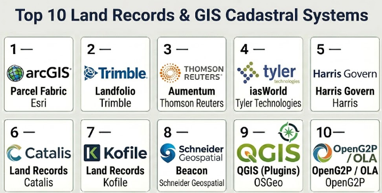
Top 10 Land Records & GIS Cadastral Systems
#1 — Esri ArcGIS Parcel Fabric
Short description :
Esri ArcGIS Parcel Fabric is a cadastral parcel management framework used by GIS teams and land administration agencies to manage parcel boundaries, records, topology, ownership-related spatial data, and historical parcel changes. It is designed for organizations that need accurate parcel editing inside an enterprise GIS environment. The platform is useful for counties, municipalities, cadastral agencies, and land records teams maintaining official parcel maps. It supports controlled editing, parcel lineage, record-driven updates, and integration with broader GIS workflows. It is best for agencies that already use ArcGIS and need strong cadastral mapping capabilities.
Key Features
- Parcel fabric management
- Cadastral parcel editing workflows
- Record-driven parcel updates
- Historical parcel tracking
- Topology and data quality controls
- Integration with enterprise GIS layers
- Support for parcel mapping and land administration workflows
Pros
- Strong fit for GIS-heavy cadastral agencies.
- Useful for accurate parcel editing and boundary maintenance.
- Works well inside a mature ArcGIS environment.
Cons
- Requires GIS expertise and proper data governance.
- May be too advanced for agencies needing only basic land record lookup.
- Licensing and implementation effort should be reviewed carefully.
Platforms / Deployment
Web / Windows / Mobile-supported workflows
Cloud / On-premise / Hybrid
Security & Compliance
SSO/SAML: Varies / N/A
MFA: Varies / N/A
Encryption: Not publicly stated
Audit logs: Varies / N/A
RBAC: Varies / N/A
SOC 2 / ISO 27001 / GDPR / HIPAA: Not publicly stated
Integrations & Ecosystem
ArcGIS Parcel Fabric is strongest when connected with enterprise GIS, land records, tax, planning, and public access workflows.
- ArcGIS Enterprise and ArcGIS Online
- Property tax systems
- Land records databases
- Survey and CAD data workflows
- Planning and zoning layers
- Public GIS portals
Support & Community
Support is generally strong through Esri’s GIS ecosystem, implementation partners, documentation, and user community. Agencies should plan for GIS staff training, parcel data migration, quality control, and workflow governance.
#2 — Trimble Landfolio
Short description :
Trimble Landfolio is a land administration and land records platform designed for governments and organizations managing land rights, property records, land registration, cadastre, and related workflows. It is useful for agencies that need to manage land ownership, title records, transactions, parcels, and land administration processes. The platform can support modernization of land registry operations and structured land information management. It is especially relevant for governments managing complex land tenure and registry workflows. It is best for agencies seeking a land administration system beyond GIS mapping alone.
Key Features
- Land records and registry management
- Land rights and title workflows
- Cadastre and parcel data support
- Transaction and application processing
- Document and record management
- Land administration reporting
- Integration with GIS and public sector systems
Pros
- Strong fit for land administration and registry modernization.
- Useful for managing land rights, titles, and cadastral records.
- Supports broader land governance workflows beyond mapping.
Cons
- Implementation can be complex for large legacy registries.
- Agencies should validate local legal and procedural fit.
- GIS depth should be reviewed based on cadastral mapping needs.
Platforms / Deployment
Web / Browser-based workflows / Varies / N/A
Cloud / On-premise / Hybrid / Varies / N/A
Security & Compliance
SSO/SAML: Varies / N/A
MFA: Not publicly stated
Encryption: Not publicly stated
Audit logs: Varies / N/A
RBAC: Varies / N/A
SOC 2 / ISO 27001 / GDPR / HIPAA: Not publicly stated
Integrations & Ecosystem
Trimble Landfolio fits agencies that need land registry, cadastral data, and land administration processes connected.
- GIS platforms
- Land registry workflows
- Document management systems
- Public access portals
- Revenue and tax systems
- Survey and cadastral data workflows
Support & Community
Support is typically project and government-agency focused. Buyers should confirm implementation services, localization support, legal workflow configuration, migration planning, and long-term maintenance.
#3 — Thomson Reuters Aumentum
Short description :
Thomson Reuters Aumentum is a property tax, land records, valuation, and recording platform used by government agencies to manage property-related records and land administration workflows. It can support property appraisal, tax administration, recording, land records, and cadastral information management. The platform is useful for jurisdictions where land records must connect with revenue, assessment, and property data workflows. It is especially relevant for counties and agencies managing property records at scale. It is best for governments that need land records connected with tax and assessment operations.
Key Features
- Property and land records management
- Assessment and valuation workflows
- Recording and document workflows
- Parcel and ownership data support
- Tax administration connectivity
- Reporting and operational dashboards
- Public sector property data management
Pros
- Strong fit for property tax and land records environments.
- Useful where land records must connect with assessment and revenue.
- Supports large-scale jurisdictional property data workflows.
Cons
- May be broader than needed for GIS-only cadastral mapping.
- Implementation can require careful data migration.
- Agencies should validate exact modules and integrations.
Platforms / Deployment
Web / Windows-supported workflows / Varies / N/A
Cloud / On-premise / Hybrid / Varies / N/A
Security & Compliance
SSO/SAML: Varies / N/A
MFA: Varies / N/A
Encryption: Not publicly stated
Audit logs: Varies / N/A
RBAC: Varies / N/A
SOC 2 / ISO 27001 / GDPR / HIPAA: Not publicly stated
Integrations & Ecosystem
Aumentum fits governments that need land records connected with property tax, assessment, and recording workflows.
- Property tax systems
- Assessment workflows
- GIS parcel layers
- Recording systems
- Public search portals
- Document management tools
Support & Community
Support is generally public-sector and implementation-focused. Agencies should confirm migration planning, configuration, staff training, integration support, and reporting setup.
#4 — Tyler Technologies iasWorld
Short description :
Tyler Technologies iasWorld is a property appraisal and tax administration system used by public sector agencies to manage property records, valuation, assessment, and related land data. While it is not only a cadastral GIS tool, it is important for agencies that connect parcel data, property ownership, assessment records, and land information. It is useful for assessor offices and property tax departments that need structured property records and integration with GIS layers. The platform can support land records workflows when paired with GIS and recording systems. It is best for agencies focused on property assessment and land-related public records.
Key Features
- Property appraisal and assessment workflows
- Ownership and property record management
- Parcel-related data support
- Tax administration connectivity
- Reporting and analytics
- Integration with GIS and land records systems
- Public sector property data workflows
Pros
- Strong fit for assessor and property tax offices.
- Useful where land records must support valuation and taxation.
- Works well as part of a broader Tyler public sector ecosystem.
Cons
- Not a dedicated cadastral mapping system by itself.
- GIS parcel editing may require separate GIS tools.
- Agencies should validate recording and registry workflow needs.
Platforms / Deployment
Web / Windows-supported workflows / Varies / N/A
Cloud / On-premise / Hybrid / Varies / N/A
Security & Compliance
SSO/SAML: Varies / N/A
MFA: Varies / N/A
Encryption: Not publicly stated
Audit logs: Varies / N/A
RBAC: Varies / N/A
SOC 2 / ISO 27001 / GDPR / HIPAA: Not publicly stated
Integrations & Ecosystem
iasWorld fits property data environments where assessment, ownership, and parcel data must connect with public records.
- GIS parcel systems
- Tax collection workflows
- Land records systems
- Public search portals
- Document management
- Tyler public sector products
Support & Community
Support is generally public-sector focused and depends on contract and implementation scope. Agencies should confirm migration help, training, integration support, and reporting configuration.
#5 — Harris Govern
Short description :
Harris Govern provides property tax, appraisal, land records, permitting, and public sector software for local governments and agencies. It helps agencies manage property data, assessments, tax-related workflows, and land information. The platform is useful where land records, property ownership, parcel data, and revenue processes must work together. It can support government departments that need operational control over land and property records. It is best for counties, municipalities, and agencies seeking integrated property and land administration workflows.
Key Features
- Property and land records support
- Assessment and appraisal workflows
- Tax administration connectivity
- Parcel and ownership data management
- Reporting and analytics
- Integration with GIS systems
- Public sector workflow support
Pros
- Useful for local government property and land records workflows.
- Good fit where assessment, tax, and land data need to connect.
- Supports multi-department public sector operations.
Cons
- Exact cadastral GIS depth should be validated.
- Implementation and migration effort may vary by agency.
- Public security and compliance details should be reviewed directly.
Platforms / Deployment
Web / Windows-supported workflows / Varies / N/A
Cloud / On-premise / Hybrid / Varies / N/A
Security & Compliance
SSO/SAML: Varies / N/A
MFA: Not publicly stated
Encryption: Not publicly stated
Audit logs: Varies / N/A
RBAC: Varies / N/A
SOC 2 / ISO 27001 / GDPR / HIPAA: Not publicly stated
Integrations & Ecosystem
Harris Govern fits agencies needing property, land, tax, and GIS-related workflows connected.
- GIS parcel data
- Tax systems
- Assessment workflows
- Land records databases
- Public portals
- Document management
Support & Community
Support is generally government-focused. Agencies should confirm implementation services, data migration, training, configuration, and long-term support before selection.
#6 — Catalis Land Records
Short description :
Catalis Land Records supports government land records, recording, property records, and public access workflows. It is useful for counties and local government offices that need to manage recorded documents, property information, indexing, search, and citizen access. The platform can help agencies digitize and manage records such as deeds, mortgages, liens, plats, and related property documents. It is especially relevant for recorder offices and registry functions. It is best for governments focused on document recording and land records search rather than parcel editing alone.
Key Features
- Land records recording workflows
- Document indexing and search
- Public access to land records
- Property document management
- Recorded instrument workflows
- Fee and transaction support where configured
- Integration with local government systems
Pros
- Strong fit for recording and registry offices.
- Useful for digitizing land record search and document access.
- Supports public-facing property document workflows.
Cons
- Not primarily a cadastral GIS editing platform.
- Agencies may need separate GIS tools for parcel fabric management.
- Integration depth should be validated during procurement.
Platforms / Deployment
Web / Browser-based workflows / Varies / N/A
Cloud / On-premise / Hybrid / Varies / N/A
Security & Compliance
SSO/SAML: Varies / N/A
MFA: Not publicly stated
Encryption: Not publicly stated
Audit logs: Varies / N/A
RBAC: Varies / N/A
SOC 2 / ISO 27001 / GDPR / HIPAA: Not publicly stated
Integrations & Ecosystem
Catalis Land Records fits agencies where document recording and public land records access are central.
- Recording workflows
- Property document databases
- Public search portals
- Payment workflows where configured
- GIS or parcel reference systems
- Local government records systems
Support & Community
Support is generally public-sector focused. Agencies should confirm indexing workflows, migration of historical records, public portal configuration, payment support, and staff training.
#7 — Kofile Land Records
Short description :
Kofile Land Records supports document preservation, digitization, recording modernization, and public access for land records offices. It is useful for agencies managing historical deeds, plats, maps, books, documents, and official recorded records. The platform and services can help governments preserve old records, digitize archives, improve searchability, and provide online access. It is especially relevant for recorder offices, clerk offices, and counties with large historical land record collections. It is best for agencies prioritizing records preservation and digital public access.
Key Features
- Land records digitization support
- Historical document preservation
- Recording and indexing workflows
- Public records search support
- Document access and retrieval
- Archive modernization
- Government records management services
Pros
- Strong fit for historical land records preservation.
- Useful for agencies digitizing old books, plats, and recorded documents.
- Helps improve public search and access.
Cons
- Not a complete GIS cadastral platform.
- Agencies may need separate parcel management and GIS tools.
- Service scope and software fit should be validated carefully.
Platforms / Deployment
Web / Browser-based workflows / Varies / N/A
Cloud / On-premise / Hybrid / Varies / N/A
Security & Compliance
SSO/SAML: Not publicly stated
MFA: Not publicly stated
Encryption: Not publicly stated
Audit logs: Varies / N/A
RBAC: Varies / N/A
SOC 2 / ISO 27001 / GDPR / HIPAA: Not publicly stated
Integrations & Ecosystem
Kofile fits land records offices focused on preservation, digitization, search, and public record access.
- Historical record archives
- Land document repositories
- Public access portals
- Indexing workflows
- County clerk and recorder workflows
- GIS reference systems where configured
Support & Community
Support is generally project and records-office focused. Agencies should confirm digitization services, indexing accuracy, public portal support, archival handling, and long-term access options.
#8 — Schneider Geospatial Beacon
Short description :
Schneider Geospatial Beacon is a GIS and property information platform used by local governments to provide public access to parcel maps, property records, tax information, and land data. It is especially useful for counties and municipalities that want to make cadastral and property information searchable online. The system helps citizens, staff, surveyors, real estate users, and businesses find parcel details through a public-facing GIS portal. It is best for agencies that need land records visibility and public parcel access rather than deep internal registry workflows.
Key Features
- Public GIS parcel search
- Property and tax data access
- Cadastral map viewing
- Parcel layer visualization
- Public-facing land information portal
- Integration with local government property data
- Search by owner, address, parcel, or location where configured
Pros
- Strong fit for public parcel and property search.
- Useful for counties and local governments serving public users.
- Helps make land records more accessible and transparent.
Cons
- Not a full land registry or parcel editing system.
- Internal cadastral maintenance may require separate GIS tools.
- Feature depth depends on agency data and configuration.
Platforms / Deployment
Web / Browser-based GIS workflows
Cloud / Varies / N/A
Security & Compliance
SSO/SAML: Varies / N/A
MFA: Not publicly stated
Encryption: Not publicly stated
Audit logs: Not publicly stated
RBAC: Varies / N/A
SOC 2 / ISO 27001 / GDPR / HIPAA: Not publicly stated
Integrations & Ecosystem
Beacon fits agencies that need online access to parcel, tax, and land records information.
- GIS parcel layers
- Property tax data
- Assessment records
- Public search portals
- Mapping workflows
- Local government records systems
Support & Community
Support is generally local-government focused. Agencies should confirm data refresh workflows, portal configuration, GIS layer support, and public access settings.
#9 — QGIS with Cadastral Plugins
Short description :
QGIS is an open-source GIS platform that can support cadastral mapping, parcel visualization, spatial editing, land records analysis, and geospatial data management when configured properly. With suitable plugins, data models, and workflows, agencies can use QGIS for cadastral mapping and land administration support. It is especially useful for budget-conscious agencies, research teams, NGOs, and GIS departments that have technical expertise. It is best for teams that need flexible GIS capabilities and are comfortable managing configuration, plugins, data quality, and support internally.
Key Features
- Open-source GIS mapping
- Parcel and cadastral layer editing
- Spatial analysis tools
- Plugin-based workflow extension
- Support for many geospatial data formats
- Desktop GIS workflows
- Integration with spatial databases
Pros
- Cost-effective and flexible for technical GIS teams.
- Strong open-source geospatial ecosystem.
- Useful for custom cadastral workflows and spatial analysis.
Cons
- Requires technical GIS expertise.
- Not a complete land registry system out of the box.
- Support and governance depend on internal team capability or partners.
Platforms / Deployment
Windows / macOS / Linux
Desktop / Self-hosted / Hybrid / Varies / N/A
Security & Compliance
SSO/SAML: Not publicly stated
MFA: Not publicly stated
Encryption: Not publicly stated
Audit logs: Not publicly stated
RBAC: Varies / N/A
SOC 2 / ISO 27001 / GDPR / HIPAA: Not publicly stated
Integrations & Ecosystem
QGIS fits agencies that need flexible spatial workflows and can manage open-source GIS infrastructure.
- Spatial databases
- PostGIS workflows
- Survey data files
- Remote sensing layers
- Public map publishing tools where configured
- Custom cadastral plugins and scripts
Support & Community
Community support is strong, but formal enterprise support depends on consultants or service providers. Agencies should plan for internal GIS expertise, data governance, backups, version control, and training.
#10 — OpenG2P / Open Land Administration Tooling
Short description :
Open-source land administration tooling, including open government and open cadastral frameworks, can help agencies build customized land records, registry, and cadastral workflows where commercial platforms may be too costly or restrictive. These approaches are useful for governments, NGOs, donor-funded projects, and land reform programs that need adaptable systems. They can support land registration, beneficiary records, geospatial data, public service workflows, and data exchange when implemented properly. However, they require strong technical governance and implementation support. They are best for agencies with custom needs and strong implementation partners.
Key Features
- Open-source land administration workflows
- Custom registry and cadastral configuration
- Geospatial data support
- Public service and beneficiary workflows where configured
- Integration with open data systems
- Flexible deployment models
- Adaptable for local policy and land tenure requirements
Pros
- Flexible for custom public sector land programs.
- Can reduce dependency on proprietary systems.
- Useful for donor-funded, reform, or modernization projects.
Cons
- Requires strong technical implementation capacity.
- Long-term support model must be planned carefully.
- Not usually ready as an out-of-the-box enterprise land registry.
Platforms / Deployment
Web / Linux-supported workflows / Varies / N/A
Cloud / Self-hosted / Hybrid / Varies / N/A
Security & Compliance
SSO/SAML: Varies / N/A
MFA: Varies / N/A
Encryption: Not publicly stated
Audit logs: Varies / N/A
RBAC: Varies / N/A
SOC 2 / ISO 27001 / GDPR / HIPAA: Not publicly stated
Integrations & Ecosystem
Open land administration tooling fits agencies that need configurable systems and have technical or implementation partner support.
- Open GIS systems
- Spatial databases
- Registry workflows
- Public service platforms
- Data exchange layers
- Custom government applications
Support & Community
Support depends heavily on the implementation partner, open-source community, and internal technical team. Agencies should plan governance, security, maintenance, documentation, and long-term ownership before adoption.
Comparison Table
| Tool Name | Best For | Platform(s) Supported | Deployment | Standout Feature | Public Rating |
|---|---|---|---|---|---|
| Esri ArcGIS Parcel Fabric | GIS-heavy cadastral parcel management | Web, Windows, mobile-supported workflows | Cloud / On-premise / Hybrid | Record-driven parcel fabric editing | N/A |
| Trimble Landfolio | Land registry and land administration agencies | Web, browser-based workflows, varies / N/A | Cloud / On-premise / Hybrid / Varies / N/A | Land rights and registry workflow management | N/A |
| Thomson Reuters Aumentum | Property tax and land records agencies | Web, Windows-supported workflows, varies / N/A | Cloud / On-premise / Hybrid / Varies / N/A | Land records connected with assessment and tax | N/A |
| Tyler Technologies iasWorld | Assessment and property records offices | Web, Windows-supported workflows, varies / N/A | Cloud / On-premise / Hybrid / Varies / N/A | Property assessment and parcel record management | N/A |
| Harris Govern | Local government property and land workflows | Web, Windows-supported workflows, varies / N/A | Cloud / On-premise / Hybrid / Varies / N/A | Integrated property, tax, and land workflows | N/A |
| Catalis Land Records | Recorder and registry offices | Web, browser-based workflows, varies / N/A | Cloud / On-premise / Hybrid / Varies / N/A | Recording and public land record access | N/A |
| Kofile Land Records | Historical records preservation and digitization | Web, browser-based workflows, varies / N/A | Cloud / On-premise / Hybrid / Varies / N/A | Land record preservation and archive modernization | N/A |
| Schneider Geospatial Beacon | Public parcel and property search portals | Web, browser-based GIS workflows | Cloud / Varies / N/A | Public GIS parcel search | N/A |
| QGIS with Cadastral Plugins | Technical GIS teams and budget-conscious agencies | Windows, macOS, Linux | Desktop / Self-hosted / Hybrid / Varies / N/A | Open-source cadastral GIS flexibility | N/A |
| OpenG2P / Open Land Administration Tooling | Custom land administration modernization projects | Web, Linux-supported workflows, varies / N/A | Cloud / Self-hosted / Hybrid / Varies / N/A | Open-source land administration flexibility | N/A |
Evaluation & Land Records & GIS Cadastral Systems
| Tool Name | Core (25%) | Ease (15%) | Integrations (15%) | Security (10%) | Performance (10%) | Support (10%) | Value (15%) | Weighted Total (0–10) |
|---|---|---|---|---|---|---|---|---|
| Esri ArcGIS Parcel Fabric | 9 | 7 | 9 | 8 | 9 | 9 | 7 | 8.25 |
| Trimble Landfolio | 9 | 7 | 8 | 8 | 8 | 8 | 7 | 7.95 |
| Thomson Reuters Aumentum | 8 | 7 | 8 | 8 | 8 | 8 | 7 | 7.70 |
| Tyler Technologies iasWorld | 8 | 7 | 8 | 8 | 8 | 8 | 7 | 7.70 |
| Harris Govern | 8 | 7 | 8 | 7 | 8 | 7 | 7 | 7.50 |
| Catalis Land Records | 8 | 8 | 7 | 7 | 7 | 7 | 7 | 7.40 |
| Kofile Land Records | 7 | 8 | 7 | 7 | 7 | 7 | 7 | 7.15 |
| Schneider Geospatial Beacon | 7 | 9 | 7 | 7 | 8 | 7 | 8 | 7.55 |
| QGIS with Cadastral Plugins | 8 | 6 | 8 | 6 | 8 | 6 | 9 | 7.40 |
| OpenG2P / Open Land Administration Tooling | 7 | 6 | 8 | 6 | 7 | 6 | 8 | 6.95 |
These scores are comparative and should be used as a shortlist guide. A cadastral GIS team may value parcel editing, topology, and spatial accuracy more heavily, while a recorder office may prioritize document indexing and public search. A tax department may need assessment and revenue integration, while a national land agency may need full land registry workflows. Buyers should validate data migration, GIS accuracy, security, integrations, public access, legal workflows, and long-term support before selection.
Which Land Records & GIS Cadastral System Should You Choose?
Solo / Freelancer
Solo surveyors, property consultants, GIS freelancers, and legal researchers usually do not need a full enterprise land records platform. They may only need public GIS access, desktop GIS, or official land records search tools.
For technical GIS work, QGIS with cadastral plugins can be useful if the user has spatial data skills. For official records, freelancers should use the government’s authorized land records or GIS portal rather than maintaining unofficial records.
SMB
Small municipalities, local land offices, and smaller county agencies should focus on practical parcel data management, public search, document indexing, and affordable GIS workflows. Schneider Geospatial Beacon, Catalis Land Records, Kofile Land Records, Harris Govern, and QGIS may be practical depending on whether the priority is public access, recording, preservation, property records, or GIS editing.
Smaller agencies should avoid overbuilding a complex land registry system if their immediate need is public access or document digitization.
Mid-Market
Mid-sized counties, cities, regional land offices, and property tax agencies need stronger integrations between land records, GIS, tax, recording, planning, and public access. Esri ArcGIS Parcel Fabric, Thomson Reuters Aumentum, Tyler Technologies iasWorld, Harris Govern, and Catalis Land Records may be relevant depending on workflow priorities.
Mid-market buyers should test parcel updates, ownership changes, document recording, map publishing, tax integration, and public record search during demos.
Enterprise
Large counties, state land agencies, national cadastral authorities, and multi-office land administration programs need scalability, legal workflow control, GIS accuracy, security, audit history, data migration, and strong vendor support. Esri ArcGIS Parcel Fabric, Trimble Landfolio, Thomson Reuters Aumentum, Tyler Technologies iasWorld, and open land administration tooling with strong implementation partners may be stronger candidates.
Enterprise agencies should involve GIS teams, land registry staff, survey departments, legal teams, tax offices, planning teams, IT, records teams, and public access teams before final selection.
Budget vs Premium
Budget-focused agencies may start with public GIS portals, open-source GIS, digitization projects, or targeted land records tools. This can work well when immediate needs are map viewing, document search, or historical record access.
Premium platforms are better when agencies need controlled cadastral editing, land registry workflows, parcel lineage, tax integration, official ownership workflows, and high-volume public access. Premium tools require stronger implementation planning but can reduce long-term data quality problems.
Feature Depth vs Ease of Use
A deep cadastral system must support accurate parcel editing, legal records, history, documents, and integrations. However, ease of use is also important because land records staff, GIS editors, clerks, surveyors, and public users have different skill levels.
Agencies should not choose a tool only because it has many features. They should test real workflows such as parcel splits, merges, deed indexing, ownership updates, map corrections, and public searches.
Integrations & Scalability-
Important integrations include GIS platforms, property tax systems, land registration systems, document management, public portals, payment systems, permitting systems, planning systems, survey tools, CAD data, and spatial databases.
Scalability should include parcel count, document volume, public search traffic, data layers, historical records, transaction volume, GIS editing teams, and multi-agency access. A system should support both current workloads and future land administration modernization.
Security & Compliance Needs
Land records systems manage sensitive legal, ownership, tax, and property information. Security review should be mandatory, especially for systems that allow editing, recording, public access, payments, or official registry changes.
Agencies should ask about SSO, MFA, RBAC, audit logs, encryption, backup, disaster recovery, data retention, edit history, public access controls, and export permissions. Do not assume compliance without formal documentation.
Frequently Asked Questions
1. What is a Land Records & GIS Cadastral System?
A Land Records & GIS Cadastral System helps agencies manage property records, parcel boundaries, ownership data, deeds, surveys, titles, maps, and land-related documents. It connects legal land information with geospatial mapping.
2. How is a cadastral system different from normal GIS?
Normal GIS can show maps and layers, while a cadastral system manages official parcel boundaries, legal land records, ownership-related data, parcel history, splits, merges, surveys, and land administration workflows.
3. What features matter most in cadastral systems?
Important features include parcel editing, topology control, ownership records, deed indexing, survey support, historical tracking, document management, GIS integration, public search, audit logs, and tax system integration.
4. Can land records systems integrate with property tax systems?
Yes, many land records systems integrate with assessment and property tax systems. This is important because ownership, parcel boundaries, property classification, and valuation data often affect tax billing and revenue collection.
5. Do these systems support public access portals?
Many systems support public search portals where citizens can look up parcels, ownership data, maps, tax records, and recorded documents. Access levels depend on agency policy and privacy rules.
6. What is parcel fabric?
Parcel fabric is a structured GIS data model used to manage parcel boundaries, legal records, topology, and parcel history. It helps agencies maintain accurate cadastral data over time.
7. Can open-source GIS support cadastral mapping?
Yes, open-source GIS tools such as QGIS can support cadastral mapping when properly configured. However, agencies need strong technical skills, data governance, backups, quality control, and support planning.
8. What are common mistakes when selecting these systems?
Common mistakes include ignoring data quality, underestimating migration effort, choosing a map viewer instead of a true cadastral system, skipping legal workflow review, and failing to involve both GIS and land records staff.
9. How long does implementation take?
Implementation depends on parcel volume, document history, data quality, integrations, workflows, public portal needs, and migration complexity. Large land records modernization projects often require phased implementation.
10. Why is audit history important?
Audit history helps agencies track who changed records, when changes happened, what data was modified, and how parcel or ownership information evolved. This is important for trust, legal accountability, and dispute resolution.
Conclusion
Land Records & GIS Cadastral Systems are critical for accurate property administration, legal land ownership, taxation, planning, infrastructure development, and public service delivery. The right system can improve parcel accuracy, protect historical records, support public search, connect land data with tax and permitting systems, and reduce manual work across departments. However, the best platform depends on the agency’s main need. A GIS-heavy cadastral office may prefer Esri ArcGIS Parcel Fabric, while a land registry modernization project may evaluate Trimble Landfolio.