Introduction
3D scan and photogrammetry software are tools that convert real-world objects, environments, or spaces into detailed 3D models using photos, videos, or sensor data. In simple terms, you take multiple images of an object or location, and the software reconstructs it into a digital 3D asset.
These tools are becoming increasingly important as industries shift toward digital twins, immersive experiences, and data-driven design. From construction and archaeology to gaming and eCommerce, photogrammetry is enabling faster, more accurate, and scalable 3D content creation.
Common Use Cases
- Drone-based mapping and land surveying
- Cultural heritage preservation and archaeology
- Game development and asset creation
- Product digitization for eCommerce
- Industrial inspection and reverse engineering
What Buyers Should Evaluate
- Reconstruction accuracy and detail
- Processing speed (GPU vs CPU)
- Support for large datasets (drone/LiDAR)
- Ease of use and automation
- Integration with CAD, BIM, and 3D tools
- Output formats and export flexibility
- Hardware requirements
- Cloud vs local processing
- AI-assisted features
Best for: Surveyors, architects, drone operators, VFX artists, game developers, engineers, and enterprises working with real-world data.
Not ideal for: Users working only with conceptual 3D modeling or those without access to image or scan data.
Key Trends in 3D Scan & Photogrammetry Software
- AI-driven reconstruction improving accuracy and reducing manual cleanup
- Drone and LiDAR integration for large-scale mapping workflows
- Cloud-based processing pipelines for scalability and collaboration
- Real-time preview and reconstruction capabilities
- Automation of image alignment and mesh generation
- Hybrid workflows (scan + photogrammetry) becoming standard
- Mobile photogrammetry apps enabling on-the-go scanning
- Improved interoperability with CAD, BIM, and game engines
- Subscription and usage-based pricing models
- Enterprise focus on data accuracy and compliance
How We Selected These Tools (Methodology)
- Considered industry adoption and professional usage
- Evaluated accuracy and reconstruction quality
- Assessed performance with large datasets
- Reviewed ease of use and automation features
- Analyzed integration with industry tools (CAD, GIS, VFX)
- Considered hardware flexibility (CPU/GPU support)
- Evaluated community and documentation quality
- Assessed scalability for enterprise workflows
- Reviewed innovation in AI and cloud processing
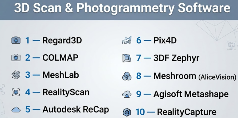
Top 10 3D Scan & Photogrammetry Software Tools
#1 — RealityCapture
Short description: A high-performance photogrammetry tool designed for fast and accurate reconstruction from images and LiDAR data, widely used in surveying and VFX.
Key Features
- Fast GPU-accelerated processing
- Supports images, drones, and laser scans
- Automatic alignment and calibration
- High-quality mesh and texture generation
- Georeferencing and mapping tools
- Large dataset support
Pros
- Extremely fast processing
- High accuracy output
Cons
- Windows-only
- Learning curve for beginners
Platforms / Deployment
Windows
Security & Compliance
Not publicly stated
Integrations & Ecosystem
RealityCapture integrates into professional pipelines for mapping and VFX.
- CAD and GIS tools
- Game engines
- Export to OBJ, FBX, etc.
- API/CLI automation
Support & Community
Strong documentation and professional support.
#2 — Agisoft Metashape
Short description: A widely used photogrammetry software for creating detailed 3D models from aerial and close-range images.
Key Features
- Dense point cloud generation
- GIS and mapping tools
- Multi-platform support
- Cloud and network processing
- Python scripting
Pros
- Highly accurate models
- Flexible workflows
Cons
- Resource-intensive
- Paid software
Platforms / Deployment
Windows / macOS / Linux
Security & Compliance
Not publicly stated
Integrations & Ecosystem
- GIS tools
- CAD workflows
- Python automation
- UAV/drone pipelines
Support & Community
Large professional user base and strong documentation.
#3 — Meshroom (AliceVision)
Short description: An open-source photogrammetry software ideal for beginners and researchers.
Key Features
- Node-based workflow
- Open-source and free
- GPU acceleration (CUDA)
- Customizable pipelines
- Image-based reconstruction
Pros
- Free to use
- Flexible workflow
Cons
- Slower processing
- Requires NVIDIA GPU
Platforms / Deployment
Windows / Linux
Security & Compliance
Not publicly stated
Integrations & Ecosystem
- Blender workflows
- Open-source tools
- Custom scripting
Support & Community
Active open-source community.
#4 — 3DF Zephyr
Short description: A complete photogrammetry solution for 3D reconstruction from images and videos.
Key Features
- Automated reconstruction
- Video-to-3D support
- Advanced editing tools
- Multiple workflow modes
- Scalable processing
Pros
- User-friendly
- Flexible pricing tiers
Cons
- Limited free version
- Performance varies
Platforms / Deployment
Windows
Security & Compliance
Not publicly stated
Integrations & Ecosystem
- CAD tools
- Export formats
- Plugin support
Support & Community
Good documentation and tutorials.
#5 — Pix4D
Short description: A professional photogrammetry software widely used for drone mapping and surveying.
Key Features
- Drone mapping workflows
- GIS integration
- Cloud processing
- Accurate geospatial outputs
- Automation tools
Pros
- Industry-grade accuracy
- Strong mapping capabilities
Cons
- Expensive
- Complex setup
Platforms / Deployment
Windows / Cloud
Security & Compliance
Not publicly stated
Integrations & Ecosystem
- GIS platforms
- Drone systems
- APIs and SDKs
Support & Community
Enterprise-grade support.
#6 — Autodesk ReCap
Short description: A reality capture software designed for converting laser scans and photos into 3D models.
Key Features
- Laser scan processing
- Cloud-based workflows
- Integration with Autodesk tools
- Point cloud editing
- BIM support
Pros
- Strong CAD/BIM integration
- Reliable workflows
Cons
- Limited photogrammetry features
- Subscription-based
Platforms / Deployment
Windows / Cloud
Security & Compliance
Not publicly stated
Integrations & Ecosystem
- AutoCAD, Revit
- Autodesk ecosystem
- Cloud collaboration
Support & Community
Professional support and documentation.
#7 — RealityScan
Short description: A mobile-first photogrammetry app designed for quick 3D capture.
Key Features
- Mobile scanning
- Real-time previews
- Cloud processing
- Easy export
- Simple UI
Pros
- Easy to use
- Accessible on mobile
Cons
- Limited advanced features
- Dependent on cloud
Platforms / Deployment
iOS / Android / Cloud
Security & Compliance
Not publicly stated
Integrations & Ecosystem
- Game engines
- Export tools
- Cloud pipelines
Support & Community
Growing user base.
#8 — MeshLab
Short description: An open-source tool focused on processing and editing 3D meshes.
Key Features
- Mesh editing and cleaning
- Point cloud processing
- Visualization tools
- Format conversion
- Scripting support
Pros
- Free and open-source
- Powerful mesh tools
Cons
- Not a full photogrammetry tool
- Technical interface
Platforms / Deployment
Windows / macOS / Linux
Security & Compliance
Not publicly stated
Integrations & Ecosystem
- Works with Meshroom
- Supports multiple formats
- Plugin ecosystem
Support & Community
Strong academic and developer community.
#9 — COLMAP
Short description: A research-focused photogrammetry tool for structure-from-motion and multi-view stereo reconstruction.
Key Features
- SfM and MVS pipelines
- Command-line tools
- High accuracy
- GPU support
- Open-source
Pros
- Highly accurate
- Flexible
Cons
- Not beginner-friendly
- Requires technical setup
Platforms / Deployment
Windows / Linux / macOS
Security & Compliance
Not publicly stated
Integrations & Ecosystem
- Research workflows
- Custom pipelines
- API support
Support & Community
Academic and research community.
#10 — Regard3D
Short description: A free photogrammetry software for basic 3D reconstruction tasks.
Key Features
- Structure-from-motion pipeline
- Multi-platform support
- Free and open-source
- Simple workflows
- Basic mesh generation
Pros
- Free
- Easy to start
Cons
- Limited features
- Slower performance
Platforms / Deployment
Windows / macOS / Linux
Security & Compliance
Not publicly stated
Integrations & Ecosystem
- Open-source tools
- Export support
- Basic pipelines
Support & Community
Small but active community.
Comparison Table (Top 10)
| Tool Name | Best For | Platform(s) Supported | Deployment | Standout Feature | Public Rating |
|---|---|---|---|---|---|
| RealityCapture | Large datasets | Windows | Self-hosted | Fast processing | N/A |
| Metashape | Accuracy | Win/macOS/Linux | Self-hosted | GIS support | N/A |
| Meshroom | Free users | Win/Linux | Self-hosted | Open-source | N/A |
| 3DF Zephyr | Ease of use | Windows | Self-hosted | Video-to-3D | N/A |
| Pix4D | Drone mapping | Win/Cloud | Hybrid | Geospatial accuracy | N/A |
| ReCap | BIM workflows | Win/Cloud | Hybrid | Autodesk integration | N/A |
| RealityScan | Mobile users | iOS/Android | Cloud | Mobile capture | N/A |
| MeshLab | Mesh editing | Cross-platform | Self-hosted | Mesh processing | N/A |
| COLMAP | Research | Cross-platform | Self-hosted | SfM accuracy | N/A |
| Regard3D | Beginners | Cross-platform | Self-hosted | Free usage | N/A |
Evaluation & Scoring of 3D Scan & Photogrammetry Software
| Tool Name | Core | Ease | Integrations | Security | Performance | Support | Value | Weighted Total |
|---|---|---|---|---|---|---|---|---|
| RealityCapture | 9 | 7 | 8 | 5 | 10 | 8 | 7 | 8.2 |
| Metashape | 9 | 7 | 9 | 5 | 8 | 8 | 7 | 8.0 |
| Meshroom | 7 | 6 | 6 | 5 | 6 | 7 | 10 | 7.1 |
| Zephyr | 8 | 8 | 7 | 5 | 7 | 7 | 7 | 7.5 |
| Pix4D | 9 | 6 | 9 | 5 | 9 | 8 | 6 | 8.1 |
| ReCap | 8 | 7 | 9 | 5 | 8 | 8 | 6 | 7.9 |
| RealityScan | 6 | 9 | 6 | 5 | 7 | 6 | 8 | 7.1 |
| MeshLab | 7 | 6 | 7 | 5 | 7 | 7 | 10 | 7.3 |
| COLMAP | 8 | 5 | 7 | 5 | 8 | 6 | 9 | 7.4 |
| Regard3D | 6 | 7 | 5 | 5 | 6 | 6 | 10 | 6.8 |
How to interpret scores:
- Scores are comparative across tools in this list.
- Higher scores indicate better overall balance.
- Performance-heavy tools may score lower in ease of use.
- Free tools score higher in value but may lack advanced features.
- Always choose based on your specific workflow.
Which 3D Scan & Photogrammetry Software Is Right for You?
Solo / Freelancer
- Best: Meshroom, Blender workflows
- Reason: low cost and flexibility
SMB
- Best: 3DF Zephyr, RealityCapture
- Reason: balance of performance and usability
Mid-Market
- Best: Metashape, Pix4D
- Reason: strong features and scalability
Enterprise
- Best: Pix4D, Autodesk ReCap
- Reason: enterprise workflows and integration
Budget vs Premium
- Budget: Meshroom, Regard3D
- Premium: Pix4D, Metashape
Feature Depth vs Ease of Use
- Deep features: Metashape, COLMAP
- Easy tools: RealityScan, Zephyr
Integrations & Scalability
- Strong: Pix4D, ReCap
- Moderate: Meshroom
Security & Compliance Needs
- Most tools: Not publicly stated
- Enterprises should validate internally
Frequently Asked Questions (FAQs)
What is photogrammetry?
It is the process of creating 3D models from multiple images by analyzing geometry and textures.
Do I need a drone for photogrammetry?
No, but drones are useful for large-scale mapping.
Is photogrammetry accurate?
Yes, especially with high-quality images and proper calibration.
What hardware is required?
Most tools benefit from strong GPUs and high RAM.
Are there free tools available?
Yes, Meshroom and Regard3D are popular free options.
How long does processing take?
It depends on dataset size and hardware.
Can I use mobile apps?
Yes, tools like RealityScan allow mobile workflows.
What industries use photogrammetry?
Construction, gaming, archaeology, surveying, and manufacturing.
Is cloud processing necessary?
Not always, but it helps with large datasets.
Can I integrate with CAD tools?
Yes, many tools support CAD and BIM workflows.
Conclusion
3D scan and photogrammetry software are transforming how real-world environments are captured and digitized. Whether you’re working on drone mapping, game assets, or industrial inspection, these tools provide scalable and accurate solutions.
There is no universal “best” option—each tool excels in different scenarios. Some prioritize speed, others accuracy, and some focus on accessibility.